NEEP533 Course Notes (Spring 1999)
Resources from Space
Lecture #14: The cool red hills of Mars!
Title: Evolution of Mars
 |
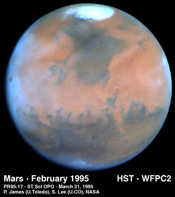
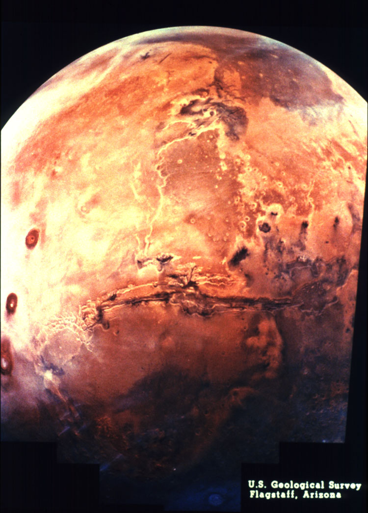
Comparison
of Earth and Mars in space (NASA Photo)
Radius 3390 km vs. 1738 km for Moon and ---km for Earth |
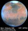 |
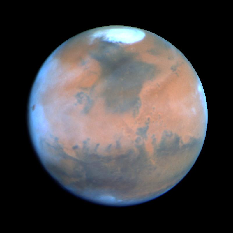
Mars (Note marked differences between northern and southern hemispheres |
Notes:
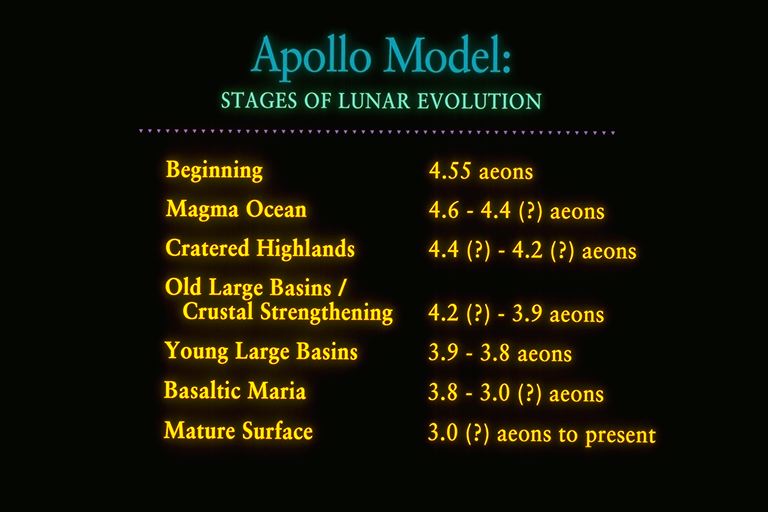 Apollo
Model: Stages of Lunar Evolution
Apollo
Model: Stages of Lunar Evolution
* Lunar Model (Lectures 10-12), with some additions, probably applies reasonably well to Mars through the Young Large Basin Stage (3.8 b.y. ago).
- * Evolution or Mars as a planet would be modified relative to Earth and Moon by:
- Intermediate radius of 3490 km (versus 6378-6275 km for Earth and 1735 km for the Moon).
- Intermediate gravitational field (versus 3/8 of Earth's and 1/6 on the Moon).
- Greater distance from the sun with semimajor axis of 1.52 AU (more abundant water, sulfur, sodium and potassium in parent portion of the solar nebula and 57% less insolation per unit area than the Earth).
- Sun also likely had a luminosity about 30% less when the planets formed than today Kasting, 1993).
- Lack of interaction with a large Moon or, alternatively, not affected by the formation of a large moon by fission of the parent body as might have been the Earth.
- Highly variable obliquity from near 0o to near 60o (currently about 25o)
- Unknown global factors:
* Some implications of above known factors on the planetary evolution of Mars.
History and size of intrinsic magnetic field, if any.
Results from Mars Global Surveyor has confirmed the absence of any present field > 5 nT at the equator (dipole moment < ~2x 10²¹ G-cm3), but has detected areas of remnant magnetism (peak fields >100 10-6 T) apparently within the older cratered terra (Acuna, et al., 1998). Earth's surface field is 0.31 X 10⁻⁴ T.
History and extent of surface water
History of rotational axis orientation
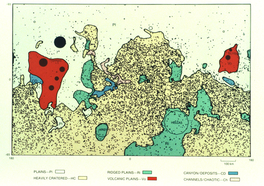
Major Stages of Martian Evolution (Synthesized largely from material presented by Munch, 1976; Carr, 1984 and 1996, and the cratering age estimates of Soderblom, 1988)- NOACHIAN SYSTEM
- BEGINNING-----------------------------------------4.57 b.y.
- MAGMA OCEAN/PLANETARY DIFFERENTIATION-------------4.5-4.4(?) b.y.
- CRATERED UPLANDS/CLAY SOUP -----------------------4.4(?)-4.2(?) b.y.
- HESPERIAN SYSTEM
- LARGE BASINS--------------------------------------4.2(?)-3.9 b.y.
- PLANETARY VOLCANISM ------------------------------3.9-2.0(?) b.y.
- AMAZONIAN SYSTEM
- MATURE CRUST/ATMOSPHERE---------------------------2.0(?) b.y.-PRES.
1. Beginning 4.57 eons- Accretion from a water and other volatile rich portion of the Solar Nebula (without possible complications of a large moon)
- Duration of a few hundred thousand years (?)
- Water retained initially by the infant Mars depended on:
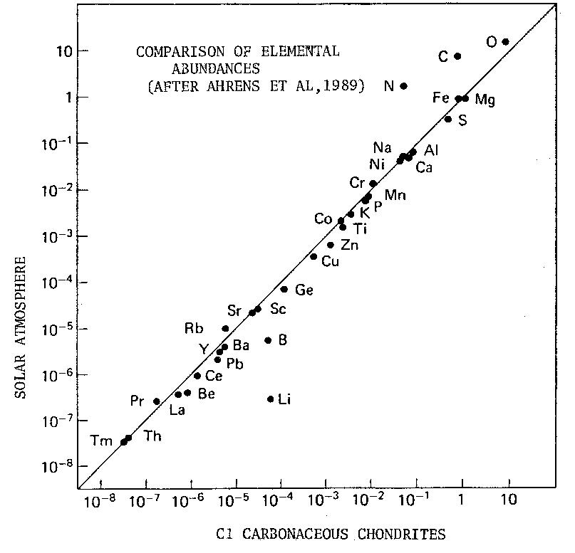
- Water content of the coalescing planetismals (carbonaceous chondrites)
 Figure:
Composition of carbonaceous chondrites
Figure:
Composition of carbonaceous chondrites - Note: Theory indicates that the solar nebula in the vicinity of Mars more water-rich than that from which the Earth/Moon system formed Carr, 1999).
- Apportionment between:
- Interior
- Surface and near-surface
- Primitive atmosphere
- Rates of introduction from interior and erosion of water from the atmosphere
- 2.Magma Ocean/Planetary Differentiation Stage [4.57-4.4(?) by ago]
- Polar moment of inertia (C/MR2) from Pathfinder Lander tracking analysis (Folkner, et al., 1998) is 0.3662 +/- ).0017, giving a compositionally unconstrained range of core radius of 1200-2400 km. Assuming a cool core (no current dipole field) with FeS/(Fe + FeS = 0.50 and a mantle Mg/Mg + Fe = 0.80 (Magma Ocean differentiation), the range of core radius is 1300-1450 km.
- Center of mass and the center of figure of Mars are offset by ~3 km (Smith and Zuber, 1996) similar to the Moon's ~2 km offset.
- Planet-wide differentiation of a silicon-rich crust and magnesium/iron rich mantle (similar to Earth and upper mantle of the Moon)
- Iron and iron-sulfur core formation would favor a magnetic field at some point, supported by the finding of areas of remnant magnetism by Mars Global Surveyor (Acuna. et a;. 1998), however, the migration of FexNiySz liquid through the lower mantle may not have been completed until after the Cratered Uplands stage as suggested by areas of remnant magnetism associated only with cratered terra..
- No subsequent differentiation of the mantle or mixing with the crust (see below).
- Note: Differentiation of Mars into a crust, mantle, and core is inferred from the density, known moment of inertia (density distribution), the Viking orbital data, the Viking surface analyses, Pathfinder in situ rock analyses ( Rieder, et al., 1997) and the composition of the SNC meteorites (see Carr, 1996). Indeed, the Mars Mg/S i vs Al/Si fractionation trend (Rieder, et al, 1997) is displaced from that of the Earth toward higher Si. The 12 known SNC meteorites have been established as coming from Mars by analysis of their volatiles which bare the distinct elemental and isotopic signature of the Martian atmosphere.
- The SNC meteorites (after Gooding, 1992, Mckay, et al., 1996, NASA)
Crust (100-200 km)
Mantle (1300-2000 km)
Core (1200-2400 km)
| METEORITE | AGE ........
(B.Y.) |
PETROLOGY (DESCRIPTION) |
| Shergotty | 0.165-0.205
0.350 |
Shock-metamorphosed basalt with pyroxene and plagioclase |
| Zagami | 0.116-0.230 | Shock-metamorphosed basalt |
| ALHA77005 | 0.187 | Shock-metamorphosed lherzolitic (olivine and pyroxene) basalt with cumulate minerals |
| EETA79001 | 0.150-0.185 | Shock-metamorphosed basalt with light colored xenoliths, melt and cumulate minerals |
| *Nakhla | 1.240-1.370 | Pyroxene-olivine cumulate or coarse basaltic lava |
| *Lafayette | 1.330
0.274-0.655 (iddingsite) |
Pyroxene-olivine cumulate or coarse basaltic lava |
| *Gov. Valadares | 1.320 | Pyroxene-olivine cumulate or coarse basaltic lava |
| *Chassigny | 1.230-1.390 | Olivine cumulate |
| ALH84001 | 4.5 | Igneous orthopyroxenite cumulate with miner maskelynite, olivine, chromite, pyrite, and apatite |
| QUE 94201
(Science News 148, 250) |
Not available | basaltic |
| LEW88516 | Not available | lherzolitic basalt |
| Y793605 | Not available | lherzolitic basalt |
- SNCs, largely basalts or cumulates with igneous textures, have a model radioisotopic age of 4.5 b.y. (same as lunar basalt model ages) indicating that there has been little or no mixing of their apparent source (the mantle) or mixing with the crust since this differentiation occurred (radioisotopes and their decay products have not been separated). In contrast, the model ages of rocks from the Earth's mantle are about 2 b.y., indicating significant mixing since it formed 4.57 b.y. ago.
- Further, the 142Nd-146Sm systematics of several of the SNCs (* above) indicate that 142Nd was conserved in Mars at least until 1.33 b.y. ago (Treiman, 1996) unlike the Earth (Bowring and Housh, 1995).
- Pathfinder/Sojourner APXS analysis of boulder "Barnacle Bill" indicates a similarity to the SNCs (Rieder, et al., 1997).
- The crystallization ages indicate that materials exist in the Martian crust that span the spectrum from 4.5 to 0.170 b.y., that is, volcanism and or magma intrusion continued throughout most of Martian history, paralleling the history of the Earth in that respect.
- The SNC exposure ages and formation ages cluster in three groups that also are distinct rock types, suggesting that they sample three distinct impact craters on Mars, one in the ancient megaregolith of the Uplands and two in the volcanic provinces of the northern hemisphere.
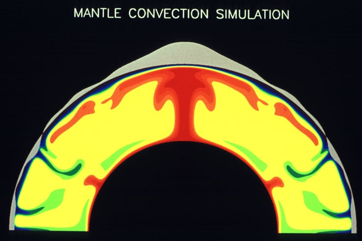
- Core formation by the movement of liquid iron, probably mixed with nickel and sulfur, released potential energy and is estimated to have raised the temperature of Mars by 300o K. This heat at least added to the depth of the Magma Ocean, if not causing the entire mantle to melt, slowed its rate of mantle crystallization, and probably enhanced the tendency of the mantle/magma ocean to transfer heat by convection.
- Core formation also may have converted much or all of the water in the young mantle to hydrogen as Feo reduced H2O to FeO + H2. This hydrogen may then have reduced carbon to methane (CH4) and nitrogen to ammonia (NH4). Methane and ammonia migration to the surface may have played a critical role in the warming of the primitive Martian atmosphere in the presence of a sun 25-30% less luminous than today (Sagan and Chyba, 1997). This in turn may have enhanced the stability of surface water, the production of atmospheric hydrocarbon aerosols to protect greenhouse gas NH4 against the effects of extreme UV, and the production of complex organic molecules from which life might then form.
- Note: The apparent small volume of the lunar core relative to the Martian core and the evidence of an undifferentiated lower lunar mantle suggests that lunar core formation heating was not significant during the lunar Magma Ocean Stage other than possibly removing H2O from the lunar interior.
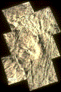
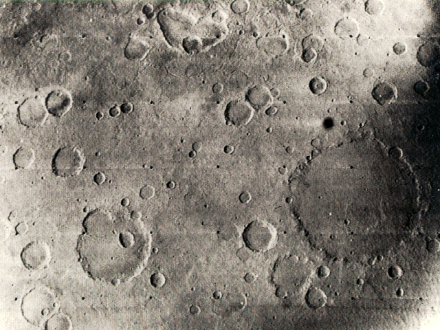
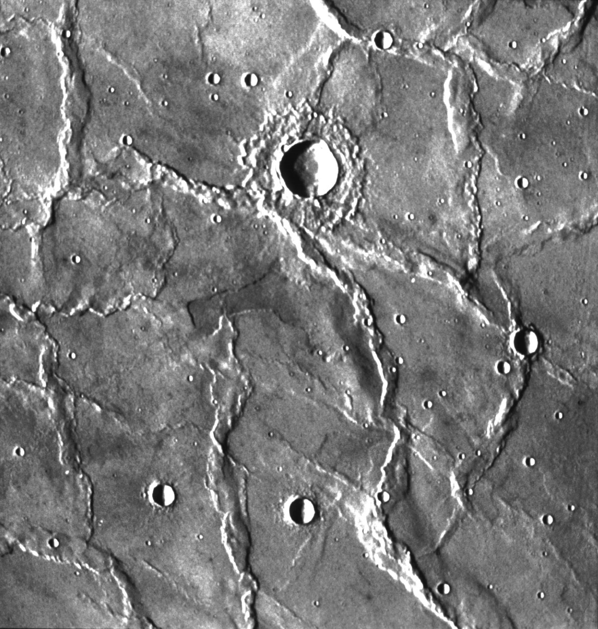
3. Cratered Uplands/Clay Soup - 4.4(?)-4.2(?) b.y.- Highly cratered crust similar to lunar highlands.

 Figure:
Cratered Uplands of Noachis (NASA Life on Mars #2)
Figure:
Cratered Uplands of Noachis (NASA Life on Mars #2)
- Formation of a megaregolith to about 10 km similar to the 25 km thick megaregolith of the Moon.
- Probable dense, moist, CO2 rich atmosphere with significant CH4, CH4 derived aerosols, and NH4 (Sagan and Chyba, 1997, and Kasting, 1997)
- Figure: Megaregolith drawing
- Note: The nature and evolution of the Martian atmosphere through time consists of many uncertainties, including the following (see Carr, 1996, Chapters 5-7):
- Initial composition
- Potential of a late infall of water-rich (cometary) material [not likely based on comparison of D/H rations of Earth's water with that measured for comets Hale-Bopp and Hyakutake (Owen,T., and Meier, R., 1997, reported in Science, 277, 318)]
- Variability of obliquity of rotational axis
- Changes in insolation
- Changes in composition due to core formation
- Changes in composition due to weathering of the megaregolith
- Changes in composition due to magmatic and hydrothermal activity
- Amount and stability of greenhouse gases (NH4, CH4, CO2, H2O) through time
- Degree of CH4 derived organic aerosol formation
- Amount and rate of surface regolith carbonate decomposition due to UV radiation (Mukhin, et al., 1996).
- Degree of impact erosion through the Large Basin Stage, below.
- Degree of hydrodynamic entraining by hydrogen escaping.
- Strength of the magnetic field.
- Degree of solar wind erosion (sputtering) (Kass and Yung, 1995, and Johnson, and Liu, 1996)
- Degree of water and carbonate capture and recycling in the megaregolith
- Probable creation and continual stirring of a soupy mixture of water, clay , carbonate, hydrocarbons and other atmospheric and crustal components (WCCH).
- Note: This probably is the most likely period for the "evolution" of complex organic molecules as precursors to replication life (possibly self replicating RNA (see Ekland and Bartel, 1996, and Science, 1996, 273, 870-872) (see Lecture 16)
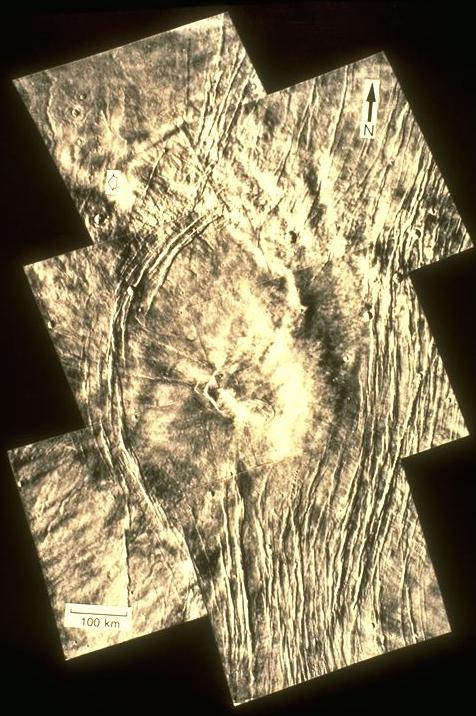
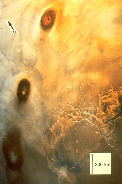
- Large, sprawling, low relief volcanos/calderas, possibly the result of the eruption of residual liquid from the Magma Ocean.
 Alba
Patera-volcano in grooved terrain (NASA Photo)
Alba
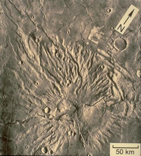
Patera-volcano in grooved terrain (NASA Photo) 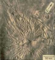 Tyrrenum
Patera-Radial volcano with channels (NASA Photo)
Tyrrenum
Patera-Radial volcano with channels (NASA Photo) - 4. Large Basins - 4.2(?) - 3.8 b.y.
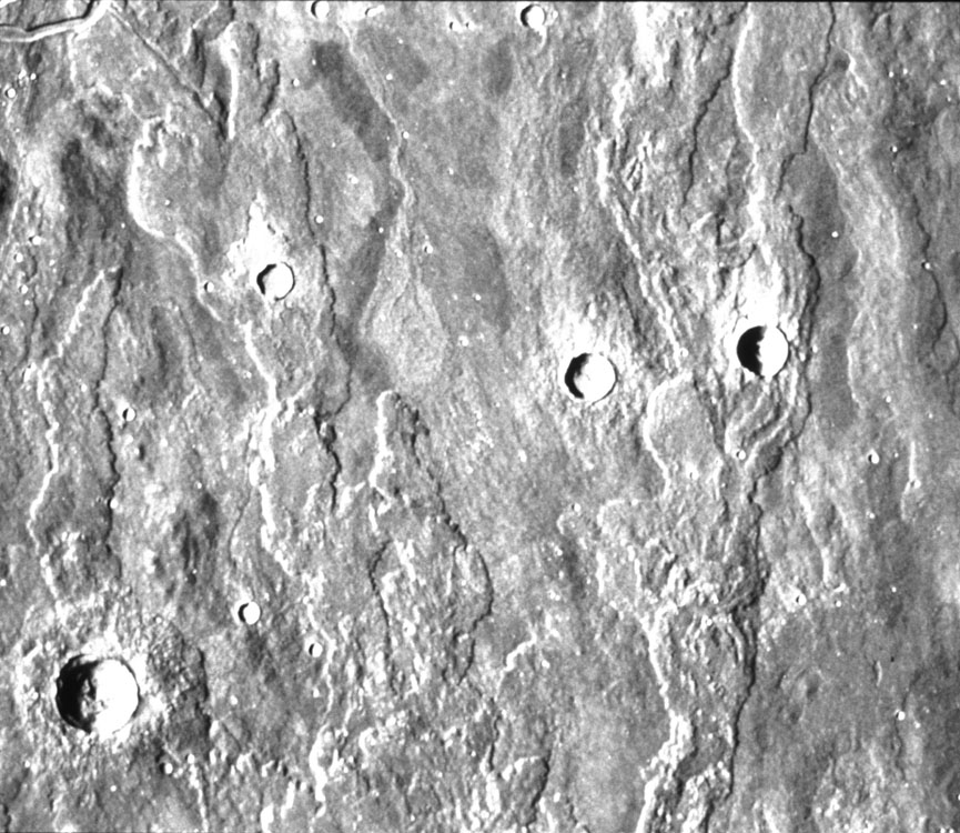
 Figure:
Upland Valley network (NASA The Red Planet #27)
Figure:
Upland Valley network (NASA The Red Planet #27) - Note: valley networks appear to have formed by sapping in the upper megaregolith (Carr, 1996), possibly sustained by increasing hydrothermal activity in response to remelting of the mantle under the Uplands. As noted in Lecture 10, these basaltic liquids would move to the top of the mantle, locally mixing with the Magma Ocean residual liquids (ur Kreep) concentrated there, and then move into the crust and on to the Martian surface, depending on the magma pressures developed by the remelting process.This movement of magmas would potentially recycle meteoric water and CO2 in the megaregolith, producing much hydrothermal activity and recycling of atmospheric volatiles.
5. Planetary Volcanism Stage - 3.8 - 2.0(?) Figure:
History of Martian Volcanism (after Greeley, 1987)
Figure:
History of Martian Volcanism (after Greeley, 1987) - Fracturing and uplift of a large region, the Tharsis Uplift #1, of the thin crust in the northern hemisphere, possibly due to phase transitions in the upper mantle as radioisotopic heat accumulated.
- Bulk of the residual liquid left from the Magma Ocean, possibly mixed with basaltic magmas from the remelting mantle (see SNC table above), possibly entered the crust and erupted to form cratered plains in the Large Basins. Within 30-40o of the equator, plains features are crisp, lunar-like. At higher latitudes, plains features are much more complex..
- Note: The alignment of three major volcanos in the Tharsis Uplift strongly suggests the migration of a convective hot spot relative to the crust, similar to that which has formed the Hawaiian island and seamount chain.
Water cycling contributed to crater and volcano erosion, with the possible interlayering of sedimentary strata along with ejecta blankets and lavas.
Formation of intercrater plains, possibly by water deposition or lavas or both.
Late in this stage, a cryosphere underlain by a hydrosphere may have begun to form as water migrated into Martian crust and the atmosphere cooled as it lost CO2 to impacts and weathering, aerosols to rain, and NH4 to EUV destruction.
Figure: Cryosphere drawing
Large basin formation largely in present northern hemisphere.
Present rotational dynamics and variability established.
Much of megaregolith concentrated in southern hemisphere.
Remelting of the warming mantle beneath the large basins may have been triggered by the release of lithostatic pressure by impact excavation.
Upland valley networks (see Carr, 1996, Chapter 4) formed late in this stage.
Organization of complex organic molecules into replicating life forms, if it occurred on Mars, probably happened at or near the end of this stage (see Lecture 16) possibly assisted by the appearance of a global magnetic field.
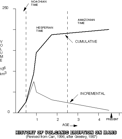
 Figure:
Lava Flows in Elysium region (NASA The Red Planet # 13)
Figure:
Lava Flows in Elysium region (NASA The Red Planet # 13)
 Figure:
Lava Flows on Elysium Mons (NASA Life on Mars #3)
Figure:
Lava Flows on Elysium Mons (NASA Life on Mars #3)
 Figure:
Hesperia Planum Ridges (NASA The Red Planet #9)
Figure:
Hesperia Planum Ridges (NASA The Red Planet #9)
Mars Global Surveyor images of lava features
in the Elysium Basin
Volcanic Rock Compositions
Pathfinder analyses (see figure below and McSween and Murchie, 1999) indicate that the rocks in the "Rock Garden" accessible to Sojourner rover, and part of the "flood plain" that drained both Hesperian and older Noachian terrain, are all similar in composition and a more silica rich rock than the expected basalt. Originally thought to be andesite, normally associated on Earth with the melting of oceanic crust subducted beneath continents, a process for which no evidence exists on Mars,the rocks are now thought to be more like rocks of similar composition but richer in Mg and Fe (islandite) that are found on Earth associated with fractional crystallization in the last stages of basaltic volcanism or from the ponding of basalt magma beneath the crust before eruption.
On the other hand, Loman (1989 and 1997) citing Yoder (1976) has suggested that "andesite" could result from the hydrous partial melting of the early mantle, however, water would probably need to move into the previously melted and depleted upper mantle from the lower mantle.
Layering
Photographs by Mars Global Surveyor have shown well-defined layering
in the walls of Valles Marineris, Coprates Chasma, and Ophir Chasma. The
layers are generally dark with brighter in-between slopes, many of which
appear to be talus but some are even brighter bedrock (Malin, et al., 1998).
Their age appears to be older than the lower Hesperian and older than the
late heavy bombardment, or between 4.2 and 3.9 by.
One hypothesis is that the layers are largely lava flows with zones of
regolith and possibly pyroclastic material between. Another is that they
are largely wind or water-lain sedimentary layers.
Layered rocks at the Pathfinder site include visual evidence of conglomerates, indicating formation in flowing water (Golombek, 1998) or shoreline environments.
Continuing or new fracturing and uplift of a large region of the thin crust
in the northern hemisphere, Tharsis Uplift #2, probably due to convection
at a hot spot in the mantle.
Figure: Viking Orbiter View of Northern Hemisphere and Tharsis region (NASA Volcanos #4)


- Note:Pathfinder/Sojourner APXS analysis of boulder "Barnacle Bill," which seems to have a chemical relationship to the SNCs (Reider, et al., 1997), possibly also has as much as 54% SiO2 (EOS, v78, p 389-390). This suggests that igneous differentiation or fractional melting of sediments produced lavas approaching the compositions of those seen in andesite provences on Earth, such as the Andes.
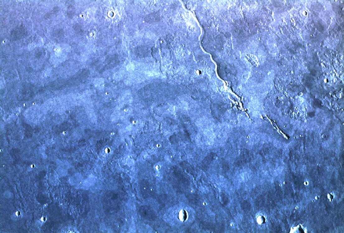
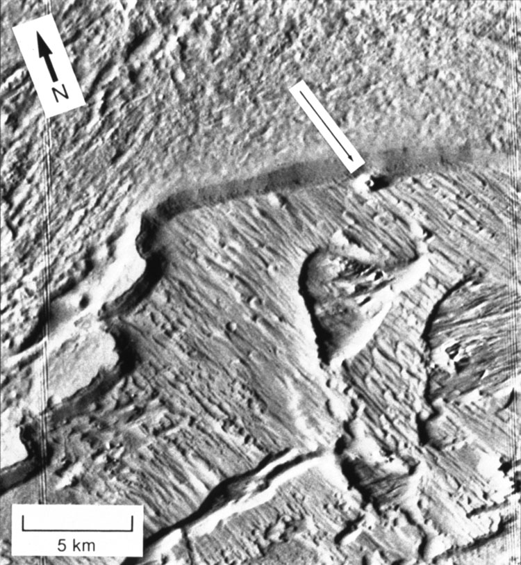
- Valles Marineris, a major extensional fracture, 5000 km long, probably formed in response to the same forces that produced the Tharsis Uplift #2 but then became an outflow channel.
 Valles
Marineris (NASA Photo)
Valles
Marineris (NASA Photo)  Full Image
  Figure:
Size of Valles Marineris (NASA The Red Planet #5)
Figure:
Size of Valles Marineris (NASA The Red Planet #5)  Figure:
Valles Marineris closeup (NASA The Red Planet #6)
Figure:
Valles Marineris closeup (NASA The Red Planet #6)  Erosion
channel (NASA Photo)
Erosion
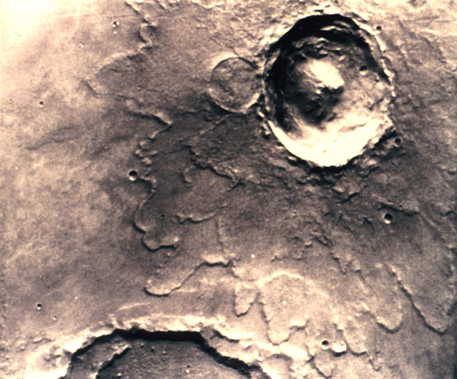
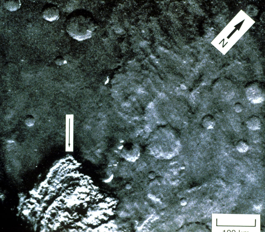
channel (NASA Photo) - Continued impact cratering at a declining rate
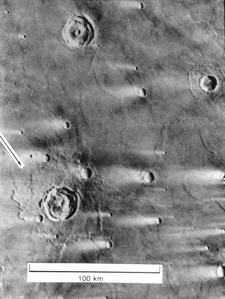
- Note: all craters north and south of 40o latitude have features, such as ramparts at the outer edge of ejecta, that suggest the presence of a cryosphere and/or hydrosphere in the megaregolith
 Figures:
Impact Crater Distribution (NASA Stones, Wind and Ice #l)
Figures:
Impact Crater Distribution (NASA Stones, Wind and Ice #l)  Figure:
Fresh Impact Crater (NASA Stones, Wind and Ice #13)
Figure:
Fresh Impact Crater (NASA Stones, Wind and Ice #13)  Figure:
Rampart Impact Crater (NASA Stones, Wind and Ice #28)
Figure:
Rampart Impact Crater (NASA Stones, Wind and Ice #28)  Figure:
Landside in Valles Marineris (NASA The Red Planet #7)
Figure:
Landside in Valles Marineris (NASA The Red Planet #7) - Volcanic eruptions continued but at less volume and frequency (See SNC discussion above). Eruption of now unfractured lavas.
- Atmosphere probably cycled between conditions resembling today's thin, cold, and windy climates and those of more dense, moist conditions, including possible transient greenhouse conditions that permitted liquid water at the surface (see Lecture 15).
- Continued formation of crustal ice and polar ice caps as atmospheric temperatures dropped due to reduced cratering rates and continued radiative cooling. Layering in the polar caps investigated by the Mars Global Surveyor team (Malin, et al., 1998) appears to be alternations between dust-rich and dust-poor ice (water in the north and carbon dioxide in the south) possibly recording changes in obliquity and the resulting variations in atmospheric pressure (Zent,1996)
Ridged and faulted plains apparently formed in response to stresses produced by the Tharsis dome.

Additions of primordial and recycled water, CO2, and other volatiles to atmosphere.
Note: If volatiles were added in sufficient quantities, a period of greenhouse warmth may have accompanied the peak of volcanism and permitted standing lakes/oceans in the basins of this time. Strandlines, overflow channels, and exposed sedimentary layers strongly suggest this happened.

Formation of outflow channels (see Carr, 1996, Chapter 3) by rapid discharges of water from a hydrosphere or rapid melting of portions of the cryosphere of both, generally originating in chaotic terrain in the Uplands, near the edges of large basins.
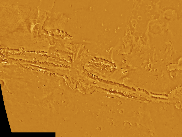

Figure: Outflow Channel into Chryse Planitia (NASA The Red Planet #25 disappeared)
Tharsis Uplift #2
Repeated sedimentation, possibly mixed with lavas and impact debris, in the Large Basins due to repeated discharges along some major outflow channels.
 Figure:
Streamlined Island (NASA The Red Planet #26)
Figure:
Streamlined Island (NASA The Red Planet #26)
Fretted (mesa, knob, and plains) terrain formed across the contact between cratered uplands and cratered plains.
 Figure:
Outflow channel Ravi Vallis (NASA The Red Planet #24)
Figure:
Outflow channel Ravi Vallis (NASA The Red Planet #24)
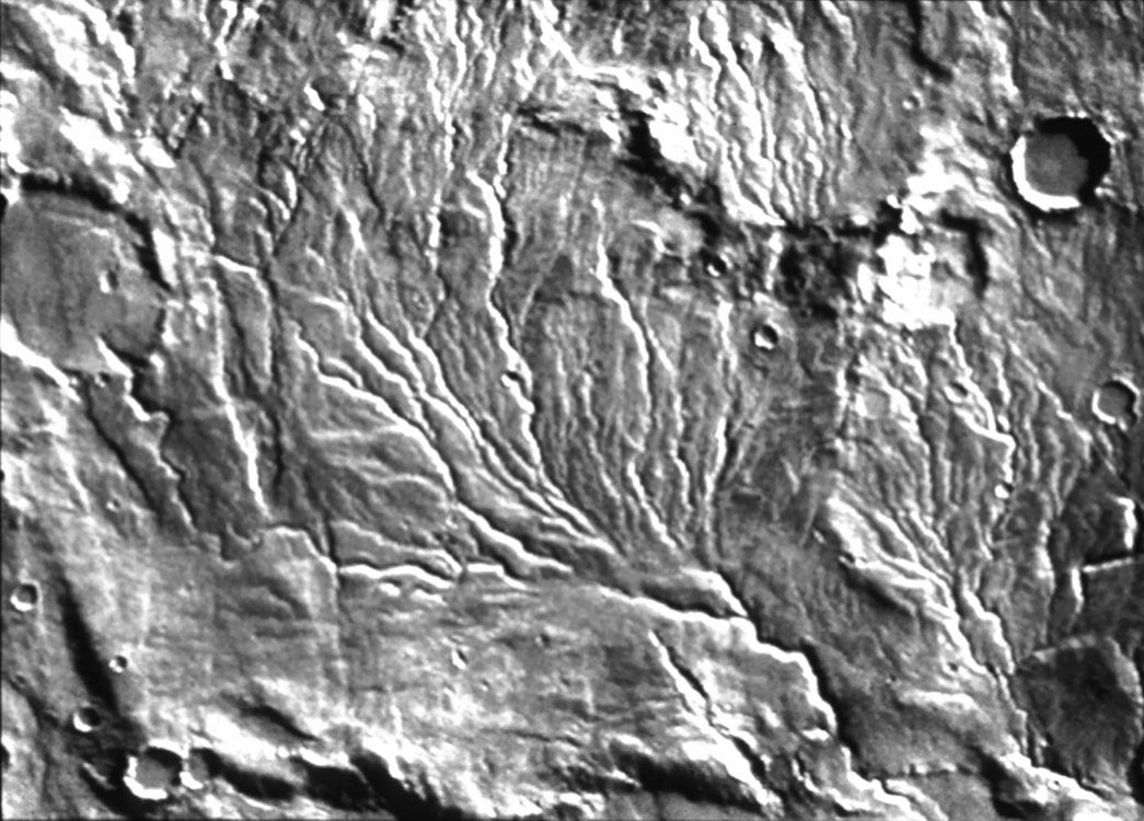
Formation of valley networks on volcano flanks by sapping ash flow tuffs or erosion from water precipitation during eruptions.
 Figure:
Valley network on Tyrrhena Patera (NASA volcanos #l7)
Figure:
Valley network on Tyrrhena Patera (NASA volcanos #l7)
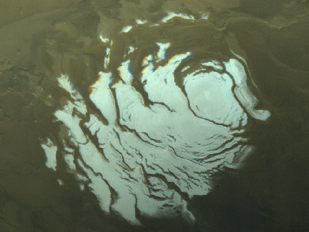
North polar ice cap (NASA Photo)
Three-Dimensional View of the North Polar Cap
Characteristics (Zuber, et al., 1998)Volume: 1.2-1.7.X106 km3 about half of the Greenland cap on Earth and equivalent to a global water layer 9m deep
Elevation above north polar basin: 3 km in a 5 km deep basin
Topography: massive cap with one major indentation with alternating light and dark layers (Malin, et al., 1998) on a scale of <10 m .
Composition: Largely water with a winter carbon dioxide cap that extends to ~60o north latitude.
Near-by impact craters: those within 100 km are filled to an unusually high level in the crater
Layered ice in the North Polar Cap
South polar ice cap (NASA Photo)
Characteristics (Zuber, et al., 1998)
Volume: 1-2? X106 km3
Elevation : km
Topography: disected cap with numerous valley indentations and alternating light and dark layers (Malin, et al., 1998) on a scale of <10 m .
Composition: Largely carbon dioxide with a winter carbon dioxide cap that extends to ~60o south latitude (Malin, et al., 1998).
On Earth during this period, Hoffman (1998) has proposed, based on strong field and isotopic evidence, that between 0.7 and 0.5 by there were two global glaciations, interrupted by periods of warmth and thick carbonate deposition.
 Layered ice in the North Polar Cap
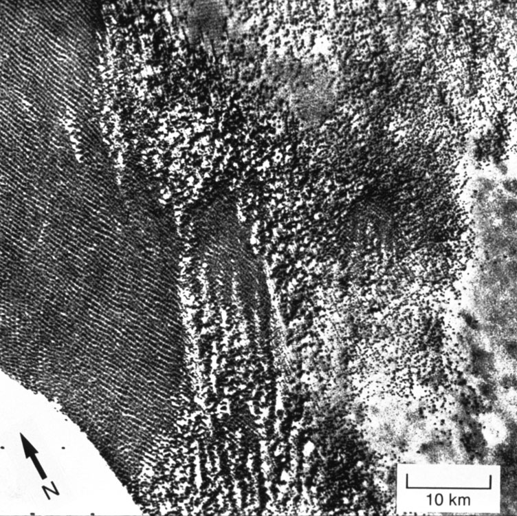
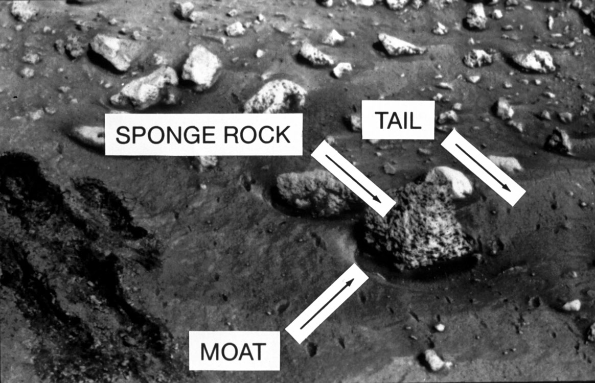
- Eolian erosion
- Wind erosion and movement of fine particles has modified many aspects
of the Martian surface and has partially homogenized at least the near-surface
portion of the "soil" (see
Lecture
16). This homogenization process has been demonstrated by the similarity
between Viking I, II, and Pathfinder soil analyses
Composition of the soil - Minerals related to weathering or alteration observed in the SNCs
- clays (montmorillonite)
- hydrated iron oxides
- serpentine
- Mg and Fe carbonates (Treiman, 1996)
- iddingsite (clay and iron oxide mixture) ( Swindel, 1997)
- Carbonates may be largely absent from the surface regolith down to several meters due to UV induced decomposition (Mukhin, 1996)
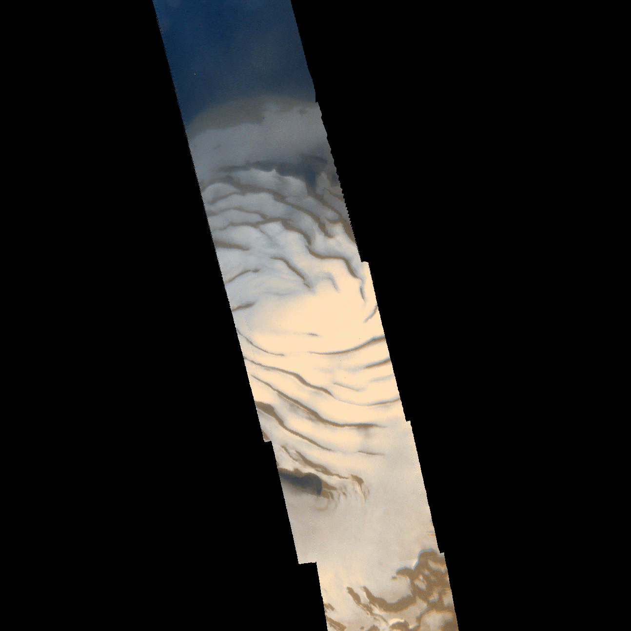
 Figure:
Dust storm at Viking-l (NASA The Winds of Mars #29)
Figure:
Dust storm at Viking-l (NASA The Winds of Mars #29)  Figure:
Dust devils (NASA The Winds of Mars#4 )
Figure:
Dust devils (NASA The Winds of Mars#4 )  Figure:
Local dust storms (NASA The Winds of Mars #2)
Figure:
Local dust storms (NASA The Winds of Mars #2)  Figure:
Dune types -transverse and barchan (NASA The Winds of Mars #11)
Figure:
Dune types -transverse and barchan (NASA The Winds of Mars #11)  Figure:
Wind streaks (NASA Stones, Wind, and Ice #19)
Figure:
Wind streaks (NASA Stones, Wind, and Ice #19) - Figure:
Eroded layers (NASA The Winds of Mars #l9)
 Figure:
White bedrock ((NASA The Winds of Mars #24)
Figure:
White bedrock ((NASA The Winds of Mars #24)  Figure:
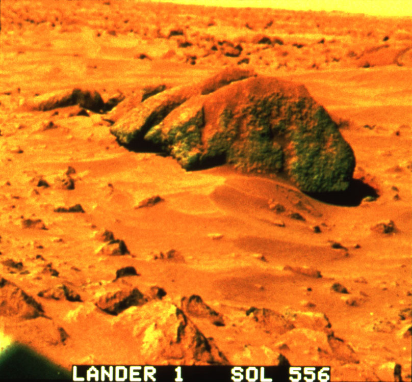
Big Joe Boulder (NASA The Winds of Mars #28)
Figure:
Big Joe Boulder (NASA The Winds of Mars #28) 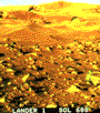 Figure:
Drifts at Viking-l (NASA The Winds of Mars #27)
Figure:
Drifts at Viking-l (NASA The Winds of Mars #27)  Figure:
Wind scour at Viking-l (NASA The Winds of Mars #25)
Figure:
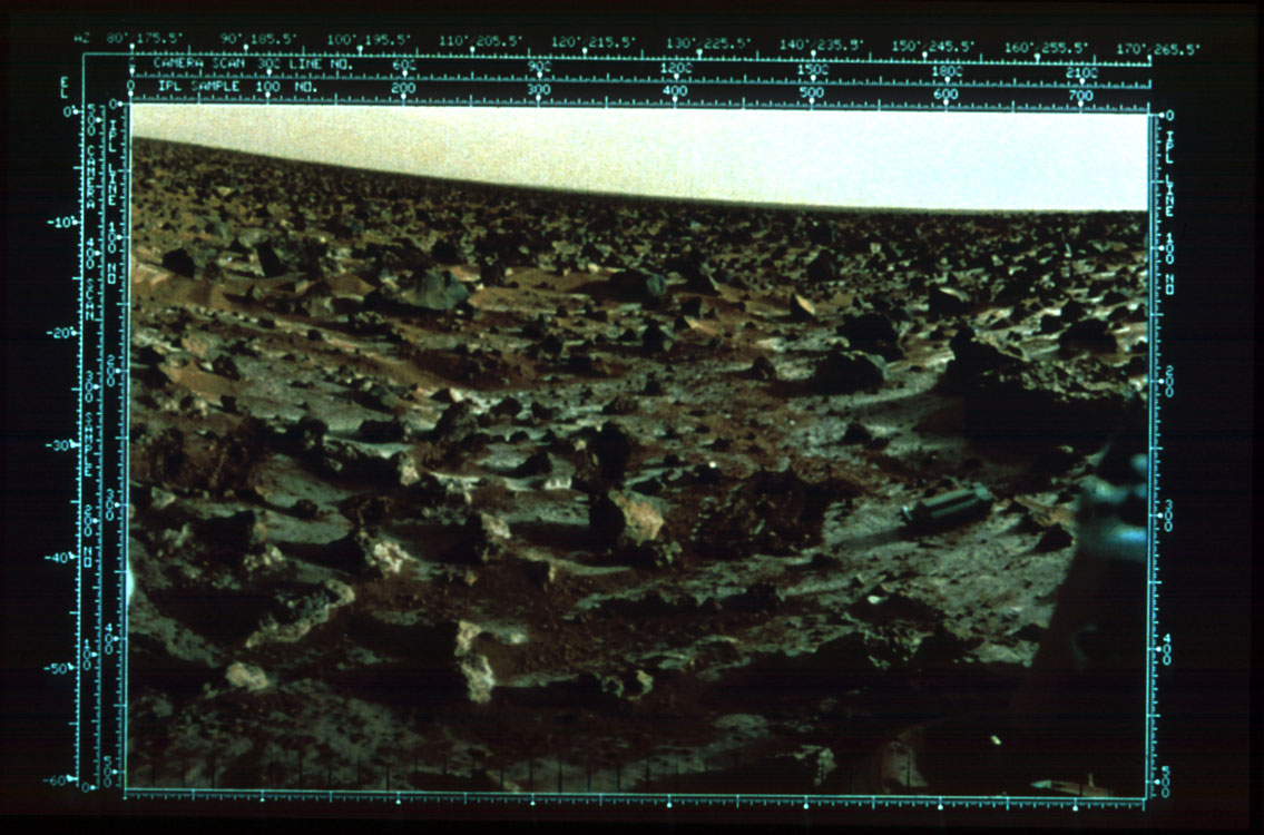
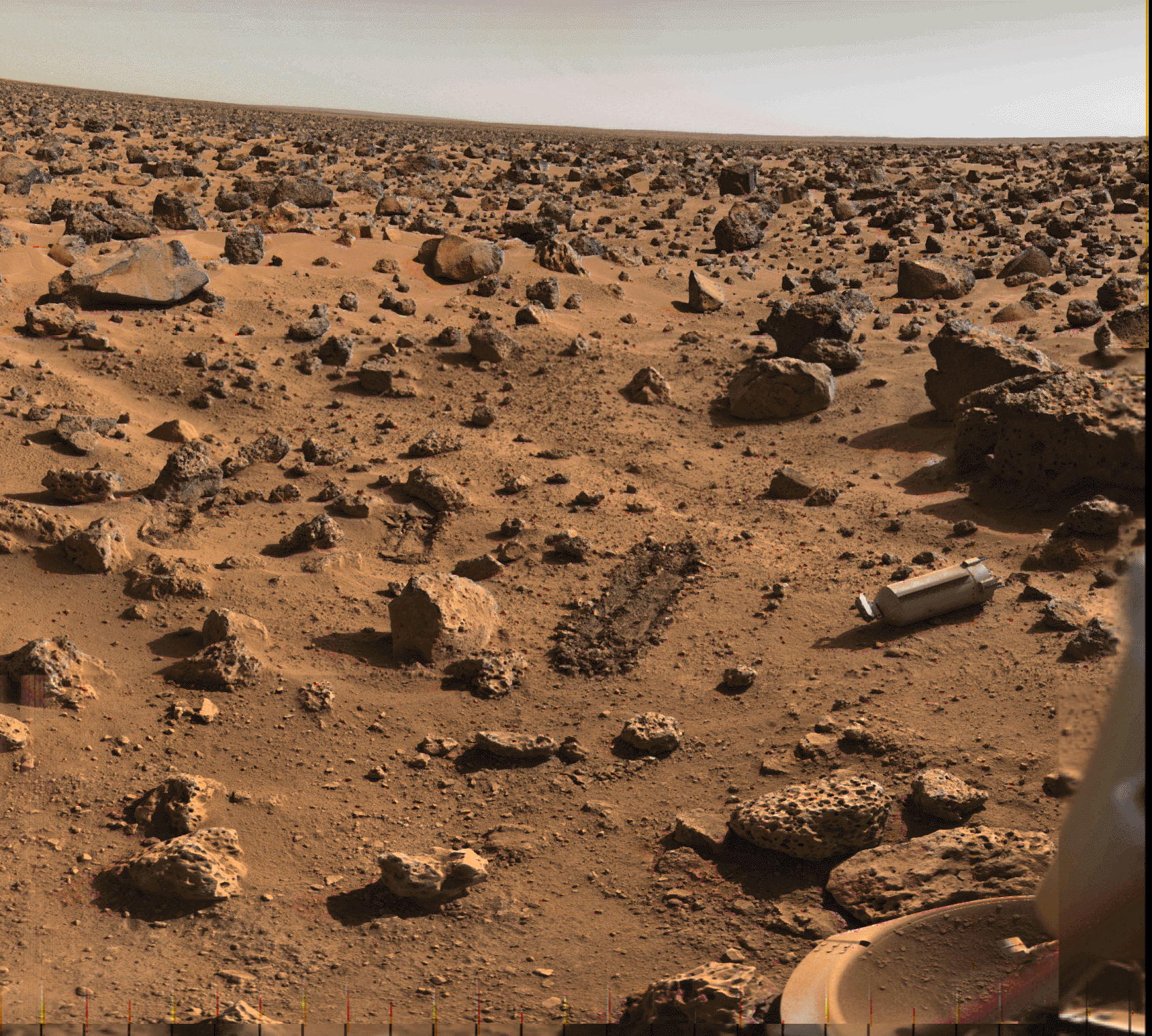
Wind scour at Viking-l (NASA The Winds of Mars #25)  View
from Viking lander (NASA Photo)
View
from Viking lander (NASA Photo)
Martian soils have been largely but not entirely homogenized by dust storms, however, some differences have been noted between the Viking sites and Pathfinder sites.
|
|
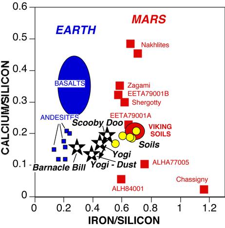
In this diagram, preliminary Pathfinder APXS analyses of soils (yellow dots) extend the range of Viking soil analyses. The analysis of Yogi appears to be contaminated by dust adhering to the rock's surface. The rock composition can be estimated by subtracting a portion of dust; the resulting Yogi composition is very similar to that of Barnacle Bill (we assumed 50% dust having the composition of drift analysis A-5 and used a linear mixing model to subtract the dust which is only strictly valid if the dust, where present, is thicker than the APXS penetration depth). Barnacle Bill is also contaminated by dust, but to a lesser extent. Much of the finer dust is slightly magnetic with two mineralogical alternatives proposed (Hviid, et al., 1997): (1) Clay phase + Maghemite (gamma-Fe2O3) which may imply previous leaching of Fe2+ by liquid water and (2) titanomagnetite or titanohaghemite in palagonite from direct weathering of glassy basalt. |
|
|
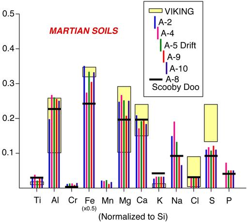
APXS analyses of Martian soils are compared with Viking soil analyses. Each element is normalized to silicon in this diagram. The yellow boxes representing Viking data include all analyses and their analytical uncertainties reported by B.C. Clark and others (1982) Journal of Geophysical Research, vol. 87, p. 10,064. Although the first APXS soil analysis (A-2) was reported to be almost identical to Viking soils, subsequent analyses demonstrate some variability and a few significant differences from Viking analyses. Specifically, soils at the Pathfinder site generally have higher aluminum and magnesium, and lower iron, chlorine, and sulfur. Scooby Doo, which appears to be a sedimentary rock composed primarily of compacted soil, also exhibits a few chemical differences form the surrounding soils. Analysis A-5 represents a deposit of windblown dust (called drift), whereas the other soil analyses may be cemented materials. |
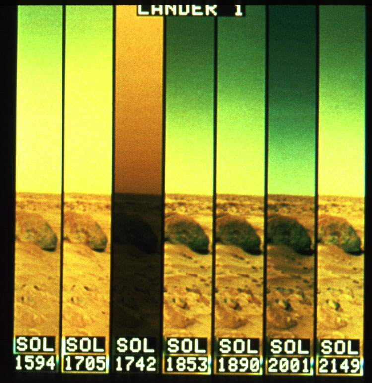
Mars Global Surveyor photo analysis indicates a strong and surprising diversity in dune age and composition in the same local area, suggesting a wide range of materials contributing to dune formation but with little mixing in many local situations (Malin, et al., 1998).
Questions:
1. Analyze and discuss the implications of the variations in solar energy received on the surface of Mars as a function of the planets orbital parameters and weather.
Text:
Mars environment material
Carr, M.H., 1996, Chapters 1-7.
References:
Acuna, M.H., et al., 1998 Magnetic Field and Plasma Observations at Mars: Initial Results of the Mars Global Surveyor Mission, Science, 279, 1676-1680.
Ahrens, et al., 1989 Formation of atmospheres during accretion of the terrestrial planets, in Origin and Evolution of Planetary and Satellite Atmospheres, S.K. Atreya, et al., editors, University of Arizona press, Tucson.
Bowring, S.A., and Housh, T., 1995, The Earth's Early Evolution, Science, 269, 1535-1540.
Carr, M.H., 1984, Mars, in M.H. Carr, et al., The Geology of the Terrestrial Planets, p207-263.
Carr, M.H., 1996, Water on Mars, Oxford University Press, New York, 229p.
Carr, M.H., 1999, Mars: Surface and Interior, in P.R Weissman, L. McFadden, and R.V. Johnson, editors, Encyclopedia of the Solar System, Academic Press, 291-308.
Crabtree, F.H., 1997, Where smokers rule, Science, 276, 222.
Ekland, E.H.and Bartel, D.P., 1996, Nature July 25 as reported in Science News, 150, 93.
Endress, M., et al., 1996, Nature, February 22 (reported in Science News, 1996, 149, p 117).
Ferris, J.P., 1996, Nature, May 2, reported in Science News, 149, 278.
Folkner, W.M., et al., 1997 Interior Structure and Seasonal Mass Redistribution of Mars from Radio Tracking of Mars Pathfinder, Science, 278, 1749-1752.
Golombek, M.P., 1998, The Mars Pathfinder Mission, Scientific American, July, 4049.
Gooding,, J.L., 1992 Soil mineralogy and chemistry on Mars: Possible clues from salts and clays in SNC meteorites, Icarus, 99, 28-41.
Gould, S.J., 1994, A Plea and a Hope for Martian Paleontology, in Neal, Valerie, editor, Where Next Columbus? The Future of Space Exploration, Oxford University Press, Oxford, 107-128p.
Hoffman, et al., 1998, Comings and Goings of Global Glaciations on a Neoproterozoic Tropical Platform in Namibia, GSA TODAY, 8, 5, 1-9.
Hoffman, P.F., et al., 1998, A Neoproterozoic Snowball Earth, Science, 281, 1342-1346.
Horowitz, N.H., 1998, The Biological Question of Mars, in D.B. Reiber, editor, The NASA Mars Conference, AAS Science and Technology Series, v 71, 177185.
Huber, C., and Wachetershauser, G., 1997, Activated acetic acid by carbon fixation on (Fe,Ni)S under primoridal conditions, Science, 276, 245-247.
Hviid, S.F., et al., 1997 Magnetic Properties Experiments on the Mars Pathfinder Lander: Preliminary Results, Science, 278, 1768-1769.
Johnson, R.E., and Liu, M, 1996, The loss of atmosphere from Mars, Science, 274, 1932.
Kass, D.M., and Yung, Y.L., 1995, Loss of Atmosphere from Mars Due to Solar Wind-Induced Sputtering, Science, v 268, 697-699.
Kasting, J.F., 1993, Science, 12 Feb, p20.
Kasting, J.F., 1997, Warming early Earth and Mars, Science, 276, 1213-1215.
Kirschvink, J.L., et al., 1998, Science, July 25
Levin, G.V., 1988, A Reappraisal of Life on Mars, in D.B. Reiber, editor, The NASA Mars Conference, AAS Science and Technology Series, v 71, 187-208.
Loman, P.D., Jr., 1989, Comparative Planetology and the Origin of Continental Crust, in Precambrian Research 44, 171-195.
Loman, P.D., Jr. 1997 Andesites on Mars: Possible Implications for the Earth, personal communication.
Malin, M.C., et al., 1998 Early Views of the Martian Surface from the Mars Orbiter Camera of Mars GlobalSurveyor, Science, 279, 1681-1685.
McKay, C.P., and Borucki, S.J., 1997, Organic synthesis in experimental impact shocks, Science, 276, 390-392.
McSween, H.Y., Jr., and Murchie, S.L. 1999, Rocks at the Mars Pathfinder Landing Site, American Scientist, 87, 36-47.
Mojzsis, S.J., et al., 1996, Nature 384, 55.
Mukhin, et al., 1996, Nature January 11 reported in Science News, 149, 21
Munch, T.A., et al., 1976, The Geology of Mars, Princeton University Press, Princeton, 400p.
Rieder, R., et al., 1997 The Chemical Composition of Martian Soil and Rocks Returned by the Mobile Alpha Proton X-ray Spectrometer: Preliminary Results from the X-ray Mode, Science, 278, 17-71-1776.
Sagan, C., and Chyba, C., 1997, The early faint sun paradox: organic shielding of ultraviolet-labile greenhouse gases, Science, 276, 1217-1220.
Smith, D.E., and Zuber, M. T, 1996, The shape of Mars and the Topographic Signature of the Nemispheric Diochotomy, Science, v 271, 184-188.
Swindel, T.D., 1997, Jounrnal of Geophysical Research-Planets as reported in Science News, 151, 210.
Soderblom, L.A. 1988, The Geology of Mars, in D.B. Reiber, editor, The NASA Mars Conference, AAS Science and Technology Series, v 71, 43-53.
Treiman, A., 1996, To see a world in 80 kilograms of rock, Science, 272, 1447-1448.
Zent, A.P., 1996, The Evolution of the Martian Climate, American Scientist, 84, 442-451.
Zuber, M.T., et al., 1998, Observations of the North Polar Region of Mars from the Mars Orbiter Laser Altimeter, Science, 282, 2053-2060.
 |
|
University of Wisconsin Fusion Technology Institute · 439 Engineering Research Building · 1500 Engineering Drive · Madison WI 53706-1609 · Telephone: (608) 263-2352 · Fax: (608) 263-4499 · Email: fti@engr.wisc.edu |
Copyright © 2003 The Board of
Regents of the University of Wisconsin System.
For feedback or accessibility issues, contact
web@fti.neep.wisc.edu.
|